Geo Earth Mapping - Municipal Mapping
A Municipal GIS system typically contains infrastructure and non infrastructure information (mapping and data) on separate map layers. These layers are turned on and off permitting users to observe spatial relationships between cultural and non cultural features. GIS also permits spatial analysis, for example, buffering around wetlands and wildlife sanctuaries to ensure that no future industrial developments would neighbour these sensitive areas.
Official Community Plans & Land Use
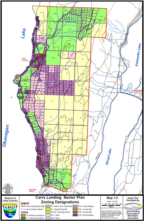
We completed a Green Space Plan for the Carrs Landing Community & Recreation Association for their sector plan project that was incorporated into the District of Lake Country's Official Community Plan
Carr's Landing Sector Plan - Zoning Map
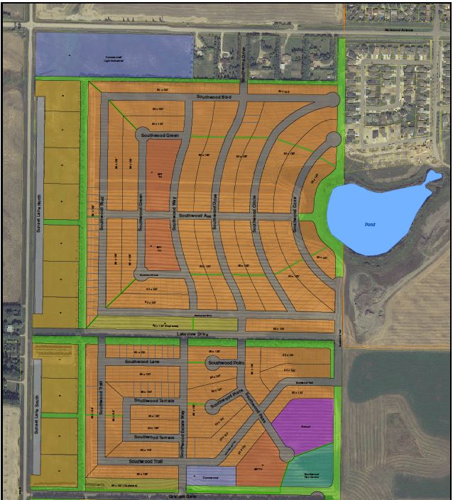
Property Plans
GIS also permits spatial analysis, for example, buffering around wetlands and wildlife sanctuaries to ensure that no future industrial developments would neighbour these sensitive areas. Green space plans are incorporated into land development plans to protect those areas.
Property Development Plan in Brandon, Manitoba